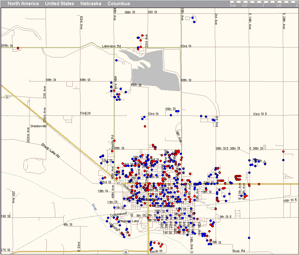
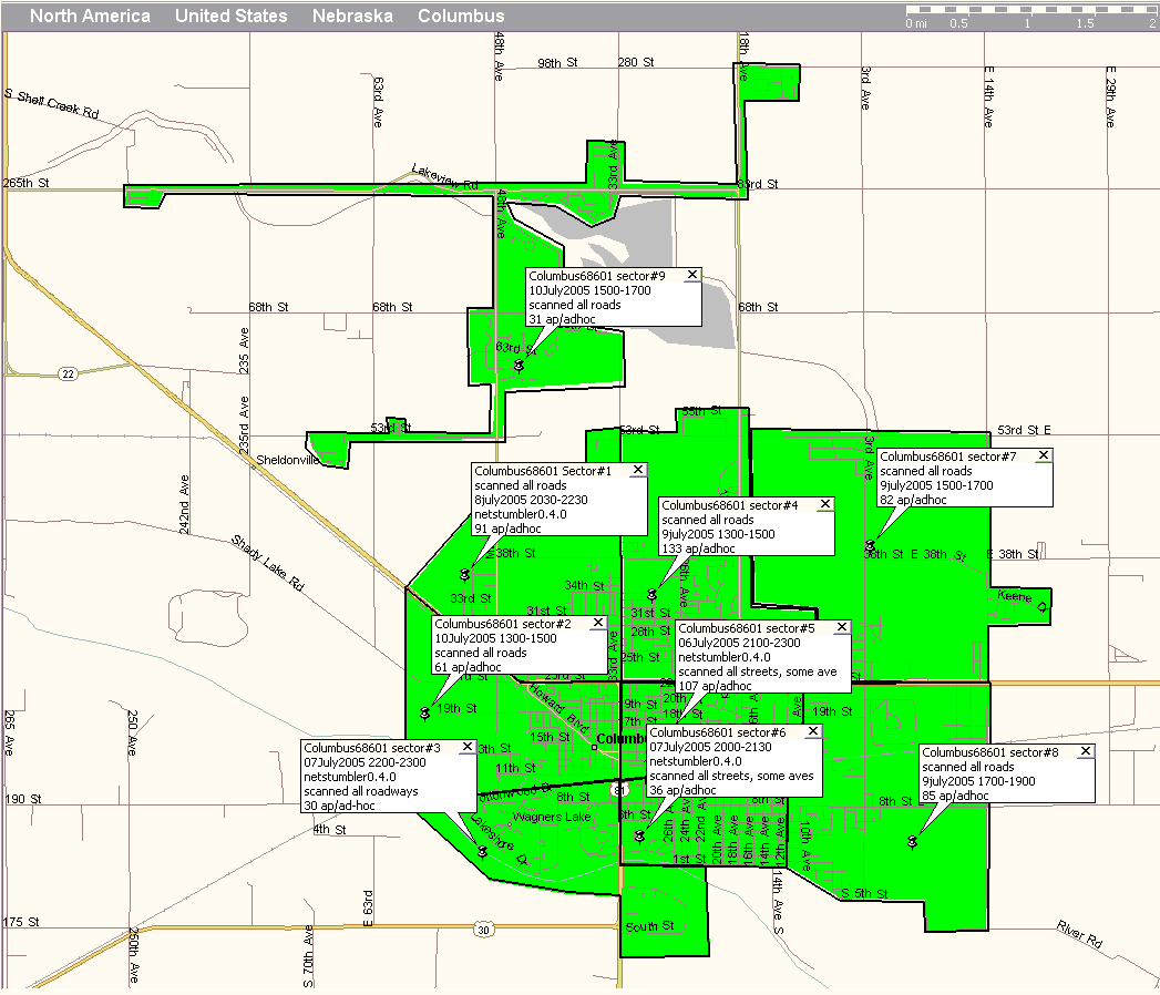
(click on numbers to enlarge)
- A laptop computer
- Wifi card or dongle
- GPS receiver
- wifi detection software (such as Netstumbler, for Windows; Kismet for Linux, and Macstumbler for Macintosh computer)
- mapping software (such as Microsoft's Streets and Trips)*
- wifi antenna (optional: helps to extend the range of your wifi card)
*Graphing entries to a map is usually done post process, however, there are programs available that can actively graph during wardriving sessions, but it requires Mappoint as the mapping software which is many times more expensive than Streets&Trips.